The Challenge Coins are wall-mounted sculptures whose designs are inspired by various military and law-enforcement “challenge coins.” These are awarded to the participants of special operations successfully undertaking aspects of particular missions. These tokens serve as both a competitive incentive for high levels of performance and a manifest form of symbolic currency, marking the acquisition of reputation.
Operation Onymous (FBI Investigation of the Silk Road), 2016 High density urethane foam, aluminum 50 ¾ × 50 ¾ × 3.14 in. Installation view at Kunsthalle Winterthur, 2017
The Challenge Coins are related to the Symbology works in the sense that they explore the visual culture of unseen things. For a longer discussion of challenge coins, see my book From the Archives of Peter Merlin, Aviation Archaeologist.
True Art… (CIA Special Activities Staff), 2016 High Temp Epoxy 50 ¾ × 50 ¾ × 3.14 in.
In 1979, astronomer W. T. “Woody” Sullivan worked with two undergraduates at the University of Washington to publish a now-classic paper entitled “Eavesdropping: The Radio Signature of Earth.” Sullivan et al. found that the brightest continuous signals emanating from earth came from military radar systems designed to detect ballistic missiles and track satellites in earth orbit, followed by carrier waves used in conventional television broadcasting. The researchers concluded that since 1957, when significant military radar systems began going online, “the earth has indeed become a very bright planet, in fact easily outshining the sun in certain narrow frequency ranges.”
The Fence (Lake Kickapoo, Texas), 2010 C-Print 50 × 40 in.
From its inception in the 1960s to its closure in 2013, earth’s most powerful radio source was a 216.983MHz signal emanating 768kW from Lake Kickapoo, Texas. Colloquially known as “the Fence” or the “Space Fence”, the Lake Kickapoo transmitter was used to track satellites overflying the continental United States as part of the military’s space surveillance network.
If human eyes could “see” radio waves in the VHF part of the spectrum, the Fence would appear as an impossibly bright sheet emanating from the southern United States and reaching far into space. I wanted to “see” the Fence, so I created a jury-rigged radio telescope from antennas, preamps, filters, a/d converters, and a software-defined radio. This image is the result of my effort to make an image of this strange piece of infrastructure.
Part of the master transmitter antenna at Lake Kickapoo, Texas, c.2001 Source: Wikipedia
In the early 2000s, I did a lot of work investigating the CIA’s so-called “extraordinary rendition” program. This was a program to kidnap, disappear, and torture people that the agency accused of terrorism.
N5177C at Gold Coast Terminal; Las Vegas, NV; Distance ~ 1 mile, 2007 C-Print 40 × 50 in.
Done mostly in collaboration with investigative journalist AC Thompson, the work involved tracking airplanes that we knew the CIA was using for the program, interviewing former prisoners, and taking a long look at the “geography” of rendition.
Workers; Gold Coast Terminal; Las Vegas, NV; Distance ~ 1 mile; 8:58 a.m., 2007 C-Print 30 × 36 in.
A few projects came out of this research: the bookTorture Taxi (co-authored with AC Thompson), as well as artworks like Seventeen Letters from the Deep State, The Black Sites, An Everyday Landscape, and more.
With the beginning of the so-called War on Terror in the early 2000s, the CIA set up a network of secret prisons in Afghanistan and elsewhere around the world. Hundreds of “ghost prisoners” went through this system of extrajudicial disappearance and imprisonment. The black sites became synonymous with torture. The locations of the secret prisons were some of the CIA’s most closely-guarded secrets.
The Black Sites The Salt Pit, Northeast of Kabul, Afghanistan, 2006 C-Print 24 × 36 in.
To find the Salt Pit, I used a collection of commercial satellite imagery, a compass, testimonies from former prisoners, and a map drawn by a former prisoner. Although they were blindfolded, hooded, and shacked, prisoners who spent time at the Salt Pit consistently describe a ten-minute ride from the Kabul International Airport to the prison. I also had a map drawn by a man named Khaled el-Masri of what he believed the interior of the prison looked like. If you draw a circle around the Kabul airport that represents the distance that one might travel in ten minutes, and compare that to el-Masri’s map, the Salt Pit jumps out at you.
The Salt Pit is located in an old brick factory a few miles northeast of Kabul, along an isolated back-road connecting Kabul to Bagram.
The Black Sites Black Site, Kabul, Afghanistan, 2006 C-Print 24 × 34 in.
The second “black site” shown here was brought to my attention by Afghan journalists and human rights activists in Kabul. The code name of this second site remains unknown.
Image Operations. Op.10, 2018 Single Channel 4K UHD Color Video Projection 5.0 Dolby Surround Sound 23 min
Shot in Berlin’s historic Funkhaus, Image Operations. Op.10 is a video installation that highlights emerging forms of computer vision and machine learning. A string quartet performs Debussy’s String Quartet in G Minor, Op. 10. As the video evolves, the perspective of the view slowly changes from that of a camera, to that of an array of computer vision systems “interpreting” what the camera is seeing. At first, we see the video through simple face detection software. As the video evolves, we begin to see the performers through the machinic eyes of algorithms used in self-driving cars, guided missiles, drones, and powerful artificial intelligence algorithms designed to estimate age, gender, and the emotional states of the performers. In sum, we watch a music performance, and simultaneously watch a version of the performance as seen by computer vision algorithms.
Rehearsal for Image Operations. Op.10, 2018
Image Operations. Op.10 demonstrates the use of many forms of automated vision systems, shows the “styles” of seeing that various computer vision systems employ, and ultimately makes the point that these technologies are far from “neutral” and are on the contrary guided by ethical and political scripts that form their ways of seeing.
Military culture is filled with a totemic visual language consisting of symbols and insignia that signify everything from various unit and command affiliations to significant events, and noteworthy programs. A typical uniform will sport patches identifying its wearer’s job, program affiliation, achievements and place within the military hierarchy.
These markers of identity and program heraldry begin to create a peculiar symbolic regime when they depict one’s affiliation with what defense-industry insiders call the “black world” – the world of classified programs, projects, and places, whose outlines, even existence, are deeply-held secrets. Nonetheless, the Pentagon’s “black world” is replete with the rich symbolic language that characterizes other, less obscure, military activities.
Installation view of Symbology series: Symbology, Volume I, 2006 Symbology, Volume II, 2007 Symbology, Volume III, 2009 Twenty fabric patches, framed 120 × 12 in.
The symbols and insignia shown in the Symbology series provide a glimpse into how contemporary military units answer questions that have historically been the purview of mystery cults, secret societies, religions, and mystics: “How does one represent that which, by definition, must not be represented?”
Shown in the publicationI could tell you but then you would have to be destroyed by me – Emblems from the Pentagon’s Black Worldfor the first time, these patches reveal a secret world of military imagery and jargon, where classified projects are known by peculiar names (“Goat Suckers,” “None of Your Fucking Business,” “Tastes Like Chicken”) and illustrated with occult symbols and ridiculous cartoons. Although the actual projects represented here (such as the notorious Area 51) are classified, these patches – which are worn by military units working on classified missions – hint at a world about which little is known.
Detail from Symbology, Volume III, 2009
Twenty fabric patches, framed
120 × 12 in.
Detail from Symbology, Volume III, 2009
Twenty fabric patches, framed
120 × 12 in.
Detail from Symbology, Volume III, 2009
Twenty fabric patches, framed
120 × 12 in.
Detail from Symbology, Volume III, 2009
Twenty fabric patches, framed
120 × 12 in.
Detail from Symbology, Volume III, 2009
Twenty fabric patches, framed
120 × 12 in.
Detail from Symbology, Volume III, 2009
Twenty fabric patches, framed
120 × 12 in.
Detail from Symbology, Volume III, 2009
Twenty fabric patches, framed
120 × 12 in.
Detail from Symbology, Volume III, 2009
Twenty fabric patches, framed
120 × 12 in.
Detail from Symbology, Volume III, 2009
Twenty fabric patches, framed
120 × 12 in.
Detail from Symbology, Volume III, 2009
twenty fabric patches, framed
120 × 12 in
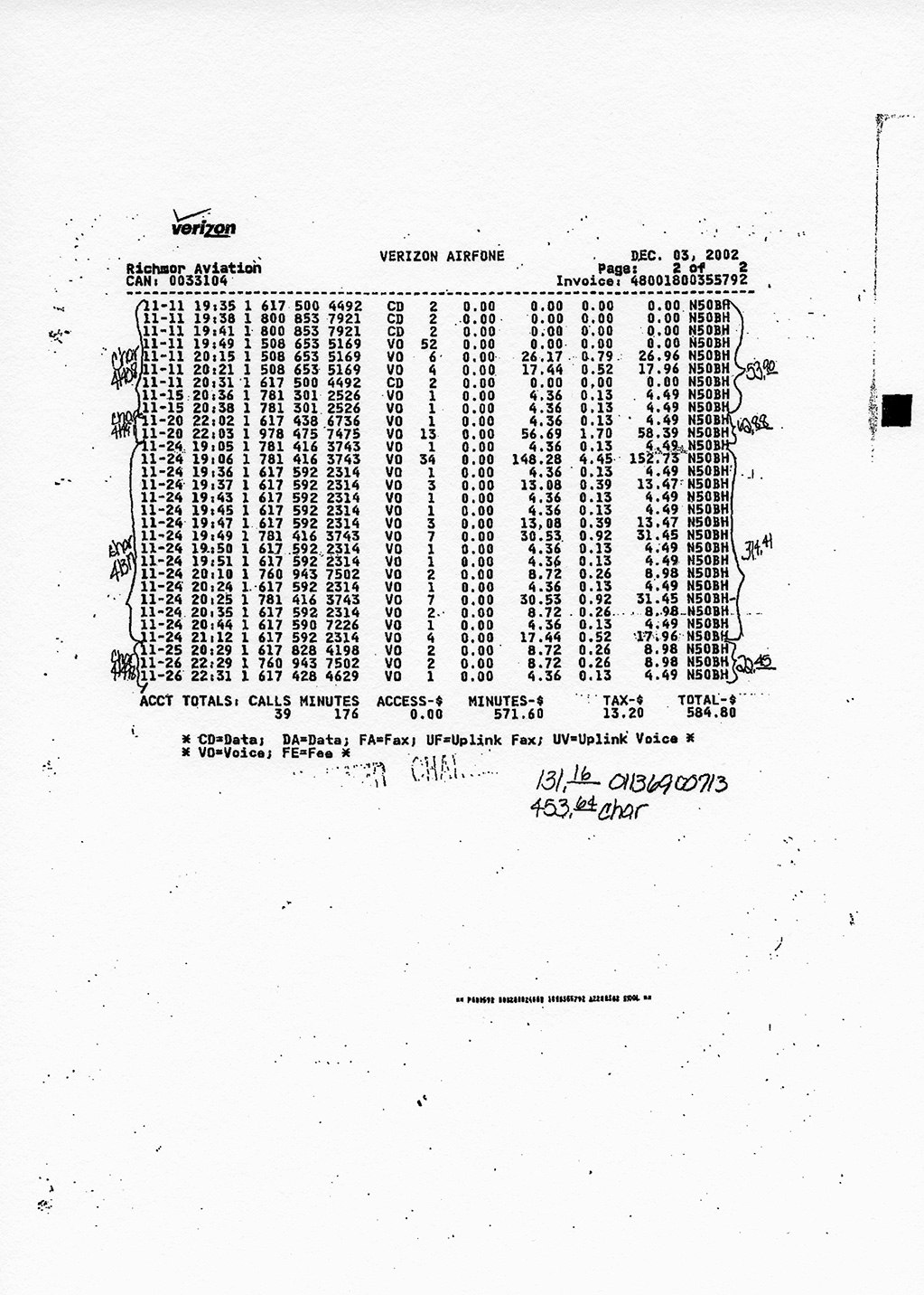
Everyday Landscape: Sportsflight Airways, Richmor Aviation, Dyncorp, Central Intelligence Agency, 1996-2006 is a sustained investigation into a network of aviation companies, private intelligence firms, state officials, and monied interests behind several covert government actions, including aspects of the CIA’s rendition program.
Everyday Landscape: Sportsflight Airways, Richmor Aviation, Dyncorp, Central Intelligence Agency, 1996-2006, 2013 Pigment prints 11 × 15 in.Detail of Everyday Landscape: Sportsflight Airways, Richmor Aviation, Dyncorp, Central Intelligence Agency, 1996-2006, 2013
Created from years of research into legal documents coupled with painstaking, paparazzi-like photographic work, the piece points towards some of the most violent and secret programs undertaken by the American government.
Research documents
Seventeen Letters from the Deep State is a piece made out of seventeen letters that were carried on airplanes used to kidnap terror-suspects around the world and bring them to a network of CIA “black sites.” The letters were meant to inform local customs agents in other countries that they should not board the private planes, as the planes were conducting US Government business. The letters are all signed by “Terry Hogan.” Each signature of Terry Hogan appears different. There is no other record of a Terry Hogan’s existence.
Install view of Seventeen Letters from the Deep State, 2011 Pigment prints 11 × 8 in.Detail view of Seventeen Letters from the Deep State, 2011 Pigment print 11 × 8 in.
The documents and landscapes I’m looking at and photographing in these works are bureaucratic and even boring looking. For me, these projects are exercises in thinking about the aesthetics of secrecy and violence.
Much of the history of surveillance, secrecy, and militarism can be found deep in the American deserts, where classified military bases and weapon ranges litter the remotest landscapes. Tucked away within massive restricted military ranges and buffered by dozens of miles of restricted land, there is often nowhere on Earth where a civilian might be able to see them with an unaided eye.
Reaper Drone; Indian Springs, NV; Distance ~ 2 miles, 2010 C-Print 30 × 36 in.Chemical and Biological Weapons Proving Ground; Dugway, UT; Distance approx. 42 miles; 11:17 a.m., 2006, 2007 C-Print 40 × 40 in.
Limit-telephotography involves photographing landscapes that cannot be seen with the unaided eye. The technique employs telescopes whose focal lengths range between 1300mm and 7000mm. At this level of magnification, hidden aspects of the landscape become apparent. Limit-telephotography most closely resembles astrophotography, a technique that astronomers use to photograph objects that might be trillions of miles from Earth. In some ways, however, it is easier to photograph the depths of the solar system than it is to photograph the recesses of the military industrial complex. Between Earth and Jupiter (500 million miles away), for example, there are about five miles of thick, breathable atmosphere. In contrast, there are upwards of forty miles of thick atmosphere between an observer and the sites in this series.
National Reconnaissance Office Ground Station (ADF-SW) Jornada del Muerto, New Mexico; Distance ~16 Miles, 2012 C-Print 37 ½ × 48 ¼ in.
In the early 2000s I spent a number of years volunteering as an anti-prison activist, mostly producing media to assist in grassroots organizing campaigns against the construction of new prisons in California. Over the course of this work, I spent time with people in rural communities where the majority of prisons were being constructed.
Color Study (Mule Creek State Prison, Ione, CA), 2016 Pigment print 48 × 80 in
California’s state prisons are massive concrete behemoths, typically housing thousands of prisoners. Set against the backdrop of sparsely populated farmlands and deserts, their presence is an overwhelming contrast to their environs. The environmental impact of prisons can be enormous in terms of water use and ecological degradation. Local people who live in their vicinity often talk about how the prisons have transformed the night sky, saturating pastoral darkness with the bright orange and green hues of their always-on floodlights.
Color Study (San Quentin State Prison, San Quentin, CA), 2016 Pigment print 48 × 80 inColor Study (Pelican Bay State Prison, Crescent City, CA), 2015 Pigment print 48 × 80 in
I think of this endlessly scrolling video installation – composed from more than 4,000 National Security Agency (NSA) and Government Communications Headquarters (GCHQ) surveillance program code names – as a kind of found poem crafted from the deliberately nonsensical names used for NSA surveillance programs.
Code Names of the Surveillance State, 2015 Video still Three channel video: HD video installation on three monitors, no sound 121 ½ × 23 × 1 ¼ in. Loop
The project was first presented to coincide with the opening of Citizenfour (2014), Laura Poitras’ documentary on Edward Snowden and the NSA, where it was projected onto various buildings in London, including Parliament.
Code Names of the Surveillance State, 2014 Projected on the British Parliament building, London, 2014